Skip to content
Digital News Report Logo
Menu
  • News
  • Business
  • Science
  • Entertainment
  • Health
  • Sports
  • Audio Books
  • Quizzes
  • Videos
Menu

Home » Current Events » 4.1 Earthquake in Central California

4.1 Earthquake in Central California

By S Wilson on December 21, 2008

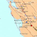
Map of earthquake epicentre

Digital News Report- A 4.1 earthquake struck central california at 9:35am this morning shaking many residents out of bed.  The epicenter was near the town of Paicines just north of Pinnacles National Monument on Highway 25.  The epicenter was located 13 miles SSE of Hollister and 56 miles SE from San Jose city hall.  It took place at a depth of 4.3 miles.

Shaking has been felt as far away as San Francisco.  The strongest shaking is being reported in the Monterey bay area including Salinas, Monterey, and Santa Cruz. 

As of this writing, there have been no reported injuries or extensive damage.


View Larger Map

  1. 6.9 Magnitude Earthquake shakes in Mexico’s Gulf of California Today
  2. Bay Area Earthquake ESE of San Jose
  3. Chile coast shakes with 7.1 Magnitude Earthquake
  4. 6.8 Magnitude Earthquake near Thailand shakes today with several major aftershocks
  5. 7.2 Magnitude Earthquake shakes near Christchurch New Zealand

Live Results Search

Categories

Important Information

This site is for informational purposes only.  Always check with your doctor or  legal council before making any medical or legal decisions.

loader-image
San Francisco, US
12:15 am, May 9, 2025
temperature icon 54°F
clear sky
Humidity 83 %
Pressure 1019 mb
Wind 12 mph
Wind Gust: 0 mph
Visibility: 10 km
Sunrise: 6:05 am
Sunset: 8:07 pm
Weather from OpenWeatherMap


©2025 Digital News Report | Design: Newspaperly WordPress Theme